

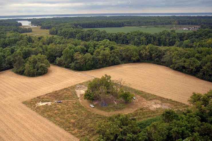
An aerial view (looking south) of Fairfield plantation in 2001, the manor house ruin is located within the central ring of trees. To the east (left) is the excavation of an early 18th-century clay borrow pit that contained a late 17th-century ash-filled tree hole (seen in a later slide). Just left of the ring of trees is the excavation area for the northeast corner of the mid-18th-century enclosed garden. An early-to-mid-18th-century slave quarter excavation is to the west (right). In the upper right hand corner of the field is a mid-to-late 18th-century slave quarter which is currently under investigation. The clump of trees in the upper left portion of the field is the Burwell/Thruston family cemetery and the York River is visible in the background along the top of the photo.