

Richmond Ironclads at Trent's Reach
No-Man’s Land on the James:
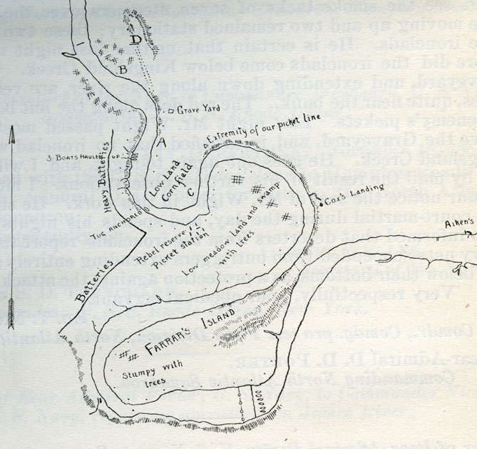
November 16, 1864
In late 1611 Farrar’s Island was the Henricus settlement meant to replace Jamestown. In late 1864 it was “the front.” This map, dated November 16, 1864, was drawn by U.S. Navy scouts studying the defenses in Henrico County.
The south side of Farrar's Island is Trent’s Reach, where (bottom of map) the U.S. obstructions are shown as lines across the river. "No-Man’s Land" ran upriver through the "Devil’s Elbow" to "C" (marked near the center of the sketch). Above that point, C.S. Navy patrols roved the river. The Confederate ironclads generally stayed closer to Richmond but sometimes sat off the Grave Yard, noted here above "C" (and below present-day Osborne's Landing).
Today the Dutch Gap Canal cuts through the neck of Farrar’s and the next point as well, while partial filling of the old channel has shifted the “island” from Henrico to Chesterfield County.
Detail from ORN Series 1 Vol. 11:73