Virginia Department of Historic Resources
(dhr.virginia.gov)
For Immediate Release
October 2025
Contact:
Ivy Tan
Department of Historic Resources
Marketing & Communications Manager
ivy.tan@dhr.virginia.gov
804-482-6445
—Markers cover topics in the counties of Mathews, Nelson, Patrick, Botetourt, and Pittsylvania, and in the cities of Suffolk, Danville, and Roanoke—
—Text of each marker reproduced below—
PLEASE NOTE: DHR creates markers not to “honor” their subjects but rather to educate and inform the public about a person, place, or event of regional, state, or national importance. In this regard, erected markers are not memorials.
RICHMOND – The Department of Historic Resources (DHR) has announced eight new historical markers coming to roadsides in Virginia. The markers will feature various topics in the commonwealth’s history, including the TransAmerica Bicycle Trail that stretches from Yorktown to the state of Oregon; the life and career of a Roanoke-based doctor who opened the first eye bank in western Virginia and one of the first eye, ear, and throat hospitals in the commonwealth; and 20th-century schools built to serve Black students during the period of segregation in Virginia’s public schools.
The Virginia Board of Historic Resources approved the markers on September 18, 2025, during its quarterly meeting in Richmond hosted by DHR.
After a decade during which recreational cycling became increasingly popular among young Americans in the 20th century, four cycling enthusiasts started to plan Bikecentennial76 in 1973 to commemorate the nation’s bicentennial. Inaugurated at Jamestown in May 1976, Bikecentennial76—a monthslong event—included tours along a specially designed route known as the TransAmerica Bicycle Trail. Stretching 4,250 miles on public roads from Yorktown to Oregon, the trail passed through Botetourt County, the proposed site for the marker. Approximately 4,100 cyclists from across the country and beyond encountered rural vistas, small communities, and historic points of interest while riding on the TransAmerica trail. The eastern third of the trail encompassed more than 500 miles in Virginia and was designated U.S. Bicycle Route 76 in 1982.
One new marker focuses on Christianity in the new republic following the end of the American Revolutionary War:
Two new markers highlight the ways in which Black Virginians contributed to the commonwealth’s economy in the 18th and 19th centuries:
Two markers recall schools built to serve Black students during the period of segregation in Virginia’s public schools:
The career of a Roanoke-based ophthalmologist who founded one of the commonwealth’s first eye, ear, and throat hospitals and western Virginia’s first eye bank grounds one new marker:
The Board also approved a marker focused on the Blue Ridge Parkway in Nelson County:
Following the Board of Historic Resources’ approval of the markers, it can take upwards of six months or more before a new marker is ready for installation. The marker’s sponsor covers the required $3,000 manufacturing expenses for a new sign.
Virginia’s historical highway marker program began in 1927 with installation of the first markers along U.S. Route 1. It is considered the oldest such program in the nation. Currently there are more than 2,600 state markers, mostly maintained by the Virginia Department of Transportation, except in those localities outside of VDOT’s authority.
Full Text of Markers:
(VDOT must approve the proposed location for each marker in its right-of-way; local public works departments must do so in jurisdictions outside VDOT’s authority.)
TransAmerica Bicycle Trail
In 1973, after a decade in which recreational cycling became increasingly popular among young Americans, four cycling enthusiasts began planning Bikecentennial76 to mark the nation’s bicentennial. The months-long event, inaugurated at Jamestown in May 1976, featured tours along a specially designed route known as the TransAmerica Bicycle Trail, which stretched 4,250 miles on public roads from Yorktown to Oregon and passed here. Roughly 4,100 riders from the U.S. and beyond encountered rural vistas, small communities, and historic points of interest. The eastern third of the TransAmerica trail, including more than 500 miles in Virginia, was designated U.S. Bicycle Route 76 in 1982.
Sponsor: Jennifer and William C. Lee
Locality: Botetourt County
Proposed Location: Catawba Road west of US 220
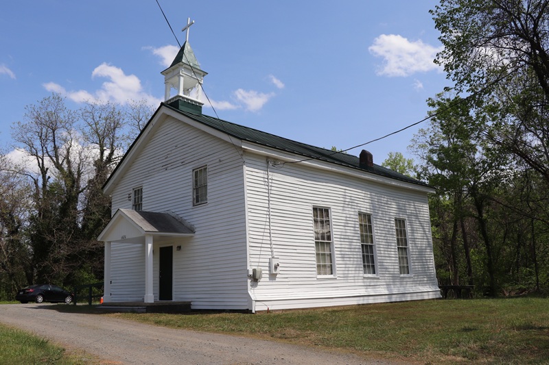
Cypress Chapel Christian Church
According to tradition, Christian worship near this site began ca. 1750. A Church of England chapel was completed in 1760 but was abandoned following the Revolutionary War. A congregation affiliated with the Christian Church, a denomination organized in 1794 after splitting from the Methodists, moved into the building and became known as Cypress Chapel Christian Church. The first regular session of the Southern Christian Convention, which formed in 1856 after a schism with northern churches, met here in 1858. The Rev. William B. Wellons, a nationally prominent leader in the denomination who had been ordained here in 1846, served as pastor until 1872. The present sanctuary was built in 1925.
Sponsor: Cypress Chapel Christian Church
Locality: City of Suffolk
Proposed Location: 1891 Cypress Chapel Road
Danville Canal
John Barnett built a canal here in 1794 that evolved from a millrace into a linchpin of the region’s transportation network. The Roanoke Navigation Company, a joint effort by Virginia and North Carolina to promote commerce by improving waterways, enhanced the 3/4-mile-long canal in the mid-1820s. Fifty enslaved laborers built three lower locks with basins and a stone upper lock and wing dam, facilitating travel around the falls of the Dan River and making coastal markets more accessible to the interior. Goods were transported on batteaux operated primarily by free and enslaved African Americans. The canal was repurposed in the 1880s to power Danville’s booming textile industry.
Sponsor: The Danville Research Center for African American History and Culture
Locality: City of Danville
Proposed Location: 424 Memorial Drive
Gilbert’s Restaurant
The Rev. Robert G. Gilbert built Gilbert’s Restaurant here ca. 1945 as a café, store, gas station, and tourist home for Black patrons during Jim Crow segregation. He and his wife, Arzelia, ran the business until 1971, after which their son and daughter-in-law operated it primarily as a restaurant until its closure in 1999. Located on US Route 29, a major artery connecting the mid-Atlantic and the Deep South, the enterprise was a regional hub for the Black community and a haven for Black travelers. Among those who stayed or dined here were Fats Domino, Lloyd Price, the Singing Siamese Twins (Yvonne and Yvette McCarther), James Earl Jones, and defense attorneys for the Martinsville Seven case.
Sponsor: Pittsylvania Historical Society
Locality: Pittsylvania County
Proposed Location: 401 N. Main Street, Chatham
Antioch (Rosenwald) School
At the urging of African American women in the Susan community, African American men built a log school ca. 1869. Antioch Baptist Church met there in its early years. In 1926-27, a new school was built here for grades one through seven. Contributions came from the Black community ($3,700), the county ($500), and the Julius Rosenwald Fund ($700), established in 1917 by the president of Sears, Roebuck, and Co. and inspired by the work of Booker T. Washington. Rosenwald funding helped build about 5,000 schools for Black students, including three in Mathews Co. Antioch School, a community hub of social and cultural activity, closed in 1948 and is the county’s only remaining Rosenwald-style building.
Sponsor: Antioch Baptist Church
Locality: Mathews County
Proposed Location: 183 Antioch Road, Susan, VA
Patrick Central School
In the late 1940s, as federal courts were requiring equity for segregated schools, the African American community in Patrick County campaigned for a consolidated school to replace inadequate facilities. In 1952, Patrick Central School opened 0.6 miles southwest of here to serve the county’s African American students in grades 1-12, providing them with a full high school education for the first time. Its athletic teams, clubs, and cultural events fostered community cohesion and pride. Alumni worked in education, government, medicine, engineering, the military, and other fields. Patrick Central was closed in 1966, when the county fully desegregated its schools to comply with federal guidelines.
Sponsor: Patrick Central School Alumni
Locality: Patrick County
Proposed Location: Salem Highway (Route 8) near intersection with Black Jack Road
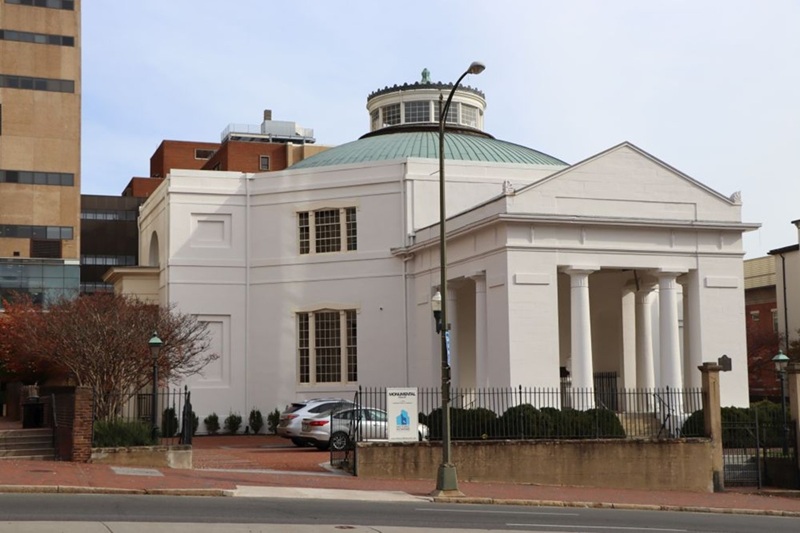
Dr. Elbyrne Grady Gill (1891-1966)
Dr. Elbyrne G. Gill, a native of Bedford County, opened the Gill Memorial Eye, Ear and Throat Hospital in this block in 1926. Through the hospital, one of the first of its specialty in VA, Gill hosted annual congresses that offered postgraduate courses for eye, ear, nose, and throat specialists. By featuring renowned faculty, including current and future Nobel laureates, these conferences attracted physicians from across the U.S. Gill, a charter member of the Roanoke Lions Club, served a term as president of Lions International in 1943-44. In 1957, he opened the first eye bank in western VA. A leader in Roanoke's civic life, Gill chaired the local board of health for 25 years.
Sponsor: Nelson Harris
Locality: City of Roanoke
Proposed Location: 700 block of South Jefferson Street
Blue Ridge Parkway
Just west of here is the northern terminus of the Blue Ridge Parkway, a 469-mile-long scenic route that links Shenandoah National Park in VA with Great Smoky Mountains National Park in NC. An internationally recognized feat of landscape architecture and engineering, the parkway was designed to highlight the scenery and cultural heritage of southern Appalachia and to stimulate the region’s economy during the Great Depression. This project, led by the National Park Service, relied on the collaboration of federal agencies, New Deal public works programs, private contractors, and the governments of NC and VA. Constructed between 1935 and 1987, the parkway is the longest linear park in the U.S.
Sponsor: American Society of Civil Engineers, Virginia Section
Locality: Nelson County
Proposed Location: Rockfish Gap Scenic Overlook, I-64 East
###