Plus, read about the projects that have been awarded funding in this year’s grant round.
By Dr. Elizabeth Moore, State Archaeologist
Established in 1985, the DHR Threatened Sites Program has supported the recovery of important archaeological data from hundreds of sites across the Commonwealth. It is a flagship program for the Division of State Archaeology at DHR. Each year, hundreds of sites in Virginia are damaged by construction, erosion, flooding, and looting. Each year, more data associated with archaeological collections are lost when they are not stored and managed in a way that retains important information. The Threatened Sites Program provides small grants to qualified archaeologists who partner with volunteers, students, and the public to counter some of that loss.
Every spring, archaeological professionals submit proposals to DHR for funding from the Threatened Sites Program. A review committee consisting of DHR archaeology staff and representatives from the Archaeological Society of Virginia (ASV) and the Council of Virginia Archaeologists (COVA) reviews, scores, ranks all proposals, and selects applicants to be funded. Threatened Sites grants tend to be small, and professional archaeologists often donate their time to these projects, using the grants to hire students or purchase supplies and equipment. These projects also often draw heavily on volunteer support, especially from ASV members. Many of them have provided field and lab training opportunities for students in the ASV/DHR/COVA certification program.
This year, DHR is funding five projects that reflect the time span from some of the earliest inhabitants in the Commonwealth thousands of years ago through the 19th century that are threatened by a variety of conditions. Read on to learn more about this year’s grant award recipients.
Evaluation and Analysis of a Shell Midden in the Poropotank River, King & Queen County
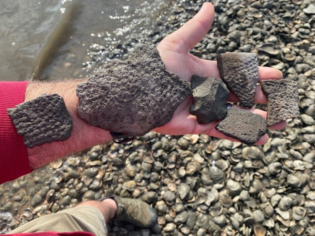
Site 44KQ0176 is a Middle Woodland Period (300-900 C.E.) shell midden and potential Native American domestic site on an island in the Poropotank River. The island was once connected to the mainland but is now a single stand of trees surrounded by marsh. The area is known locally for its oysters and was the subject of substantial oyster farming in the 19th and 20th centuries with efforts to revitalize the industry in the 21st century. Sea level rise and cataclysmic weather events are increasingly threatening the cultural and natural resources. Ancient shell middens provide unique preservation conditions; shell helps neutralize acidic soils and shell middens have provided much of the data we have of the past that can be used to examine long-term environmental change. This is done with the examination of well-preserved plant and animal remains, which are fragile materials rarely preserved at other sites.
“Kiln 2” in Elkton, Virginia
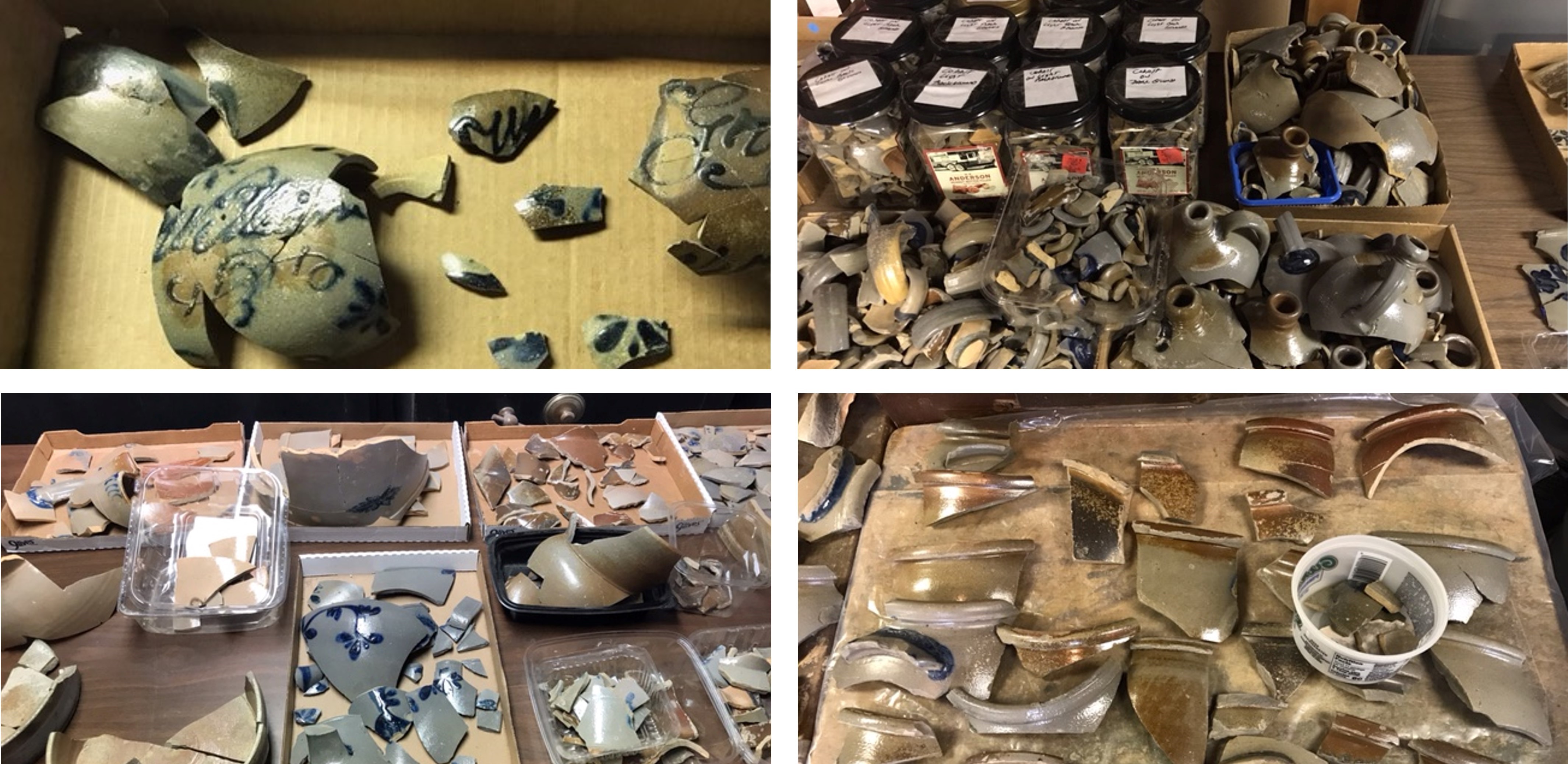
This previously undocumented kiln is part of a late 18th and 19th century pottery-distillery-tannery-mill complex owned by colonial settler Stephen Conrad. The Shenandoah Valley has a rich history of pottery production but many of the sites of these kilns and their associated artifacts have been lost due to construction, erosion, and looting. Erosion, exacerbated by cattle walking over the site, is damaging the Kiln 2 deposits. The current property owners, who are supportive of this project, have conducted hand excavations on the site, recovering thousands of sherds. The excavations proposed for this site will determine the function and dates of kiln construction and use. This work will be conducted with assistance from ASV-COVA-DHR certification program field school students, providing a valuable training opportunity.
Lynchburg Mills
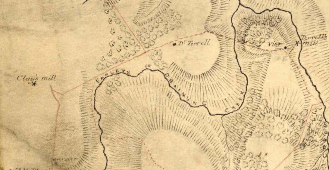
Historic maps of Lynchburg project at least eight mills in the city in the mid-19th century; only one of these sites has been recorded. Rapid expansion of the city has affected the integrity of the remaining structures/ruins of historic mills through new construction projects pushing growth closer to the river. These projects have redirected rainwater, increasing erosion along the riverbanks. Increased bank collapse threatens the stability of mill ruins and will eventually also cause the loss of associated deposits. This project proposes a water-based survey to locate the mills known from the historic record and document their current integrity status and future archaeological research potential.
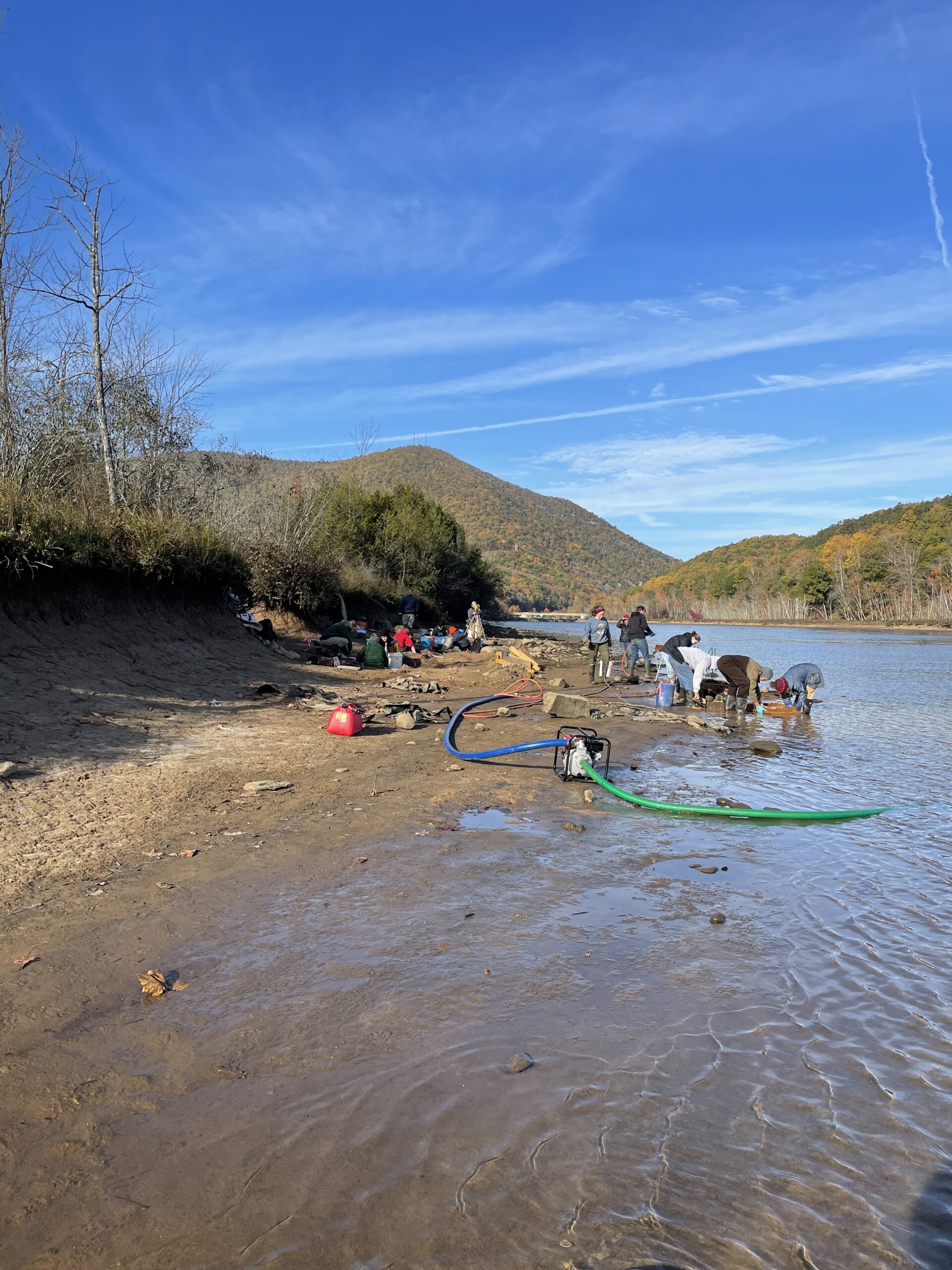
44PY98
A complex of at least six sites bearing Paleoindian or Early Archaic artifacts have been identified downstream of Smith Mountain Dam. Because of a unique erosional situation, large areas are exposed down to surfaces that date between 8,000 to 13,000 years ago. These eroded surfaces have revealed in situ artifacts that span the transition from the last Ice Age to the modern era. These sites have the potential to inform us of regional settlement patterns during the time of some of the earliest occupation of the continent. Previous testing at this site has been limited. The current project will extend excavations in depth and breadth and will use fine-grained point plotting for all artifacts to help researchers better understand depositional history and site occupation in the earliest time periods. Organic materials will be carefully collected, and radiocarbon dates will be acquired where possible to support a fuller understanding of the long history at this site.
100 Most Threatened Shoreline Sites in Northumberland, Lancaster, Middlesex, and Mathew Counties
Since the late 1960s, more than 1,100 archaeological sites have been recorded within 50 feet of the tidal shorelines of Virginia. Variations in local environmental conditions create variable levels of threat and vulnerability of these sites. In 2017 and 2018, archaeologists from Longwood University created a model to quantify the threat posed to archaeological sites based on continuing erosional trends. Testing and assessment of this model requires knowing existing site boundaries and integrity—information not available when the predictive model was created. The current project will document the 100 most threatened sites in the area addressed by the model to provide critical and essential baseline data on which to assess future site loss and to test the model. With property owner permission, shovel test pits will be excavated to determine site boundaries and integrity. Sites will be mapped and photographed, artifacts will be recorded, and all information will be provided to DHR for future analysis.