 —New listings are in the counties of Henrico, Gloucester, Loudoun, and Wythe; the Town of Luray; and the cities of Richmond, Petersburg, Winchester, and Covington—
Nine historic places were listed on the Virginia Landmarks Register today, including a recreational services facility in eastern Virginia for African American soldiers during military segregation in the 1940s, one of Shenandoah Valley’s earliest apple processing and storage facilities, and the sprawling farm of one of Southwest Virginia’s most prominent political figures and industrialists.
The commonwealth’s Board of Historic Resources approved the Virginia Landmarks Register (VLR) listings during its quarterly public meeting today. The VLR is the commonwealth’s official list of places of historic, architectural, archaeological, and cultural significance.
Located in the City of Petersburg, the Byrne Street USO Club offered recreational services and entertainment programs for African American troops during World War II. The clubhouse remained in use as a recreational and community center for the city’s African Americans after the war and into the 2010s.
The Byrne Street USO Club was constructed in 1942 as a United Service Organization (USO) facility. President Franklin D. Roosevelt created the USO on February 4, 1941, to maintain morale among soldiers shortly before the country entered World War II. The U.S. military provided supplies and labor for the construction of USO buildings. Until the end of the war, the Byrne Street USO Club functioned as a space for Black servicemen to socialize safely and for the troops and their families to receive aid. The clubhouse shared a variety of programs with Black servicemen and civilians in the City of Petersburg, from music recitals and scholarly presentations to radio broadcasts and sports activities.
In the City of Winchester, the C. L. Robinson Ice and Cold Storage plant holds a significant place in the history of the local apple industry in the Shenandoah Valley, a region that has been recognized as an ideal environment for apple cultivation since the colonial period. By the early 20th century, a combination of capital investment and Winchester’s role as a regional rail hub spurred the rapid growth of the Valley’s apple industry.
In 1902, Charles L. Robinson, an ice and coal dealer who relocated to Winchester from West Virginia, purchased the plant and became one of the city’s leading industrialists and civic figures. The growth of the C. L. Robinson Ice and Cold Storage Corporation paralleled the rise of the apple industry in Virginia, and by the mid-20th century, Winchester was widely recognized as the apple capital of the eastern U.S. The closing of the plant in 1997 ended an era in the city’s industrial past.
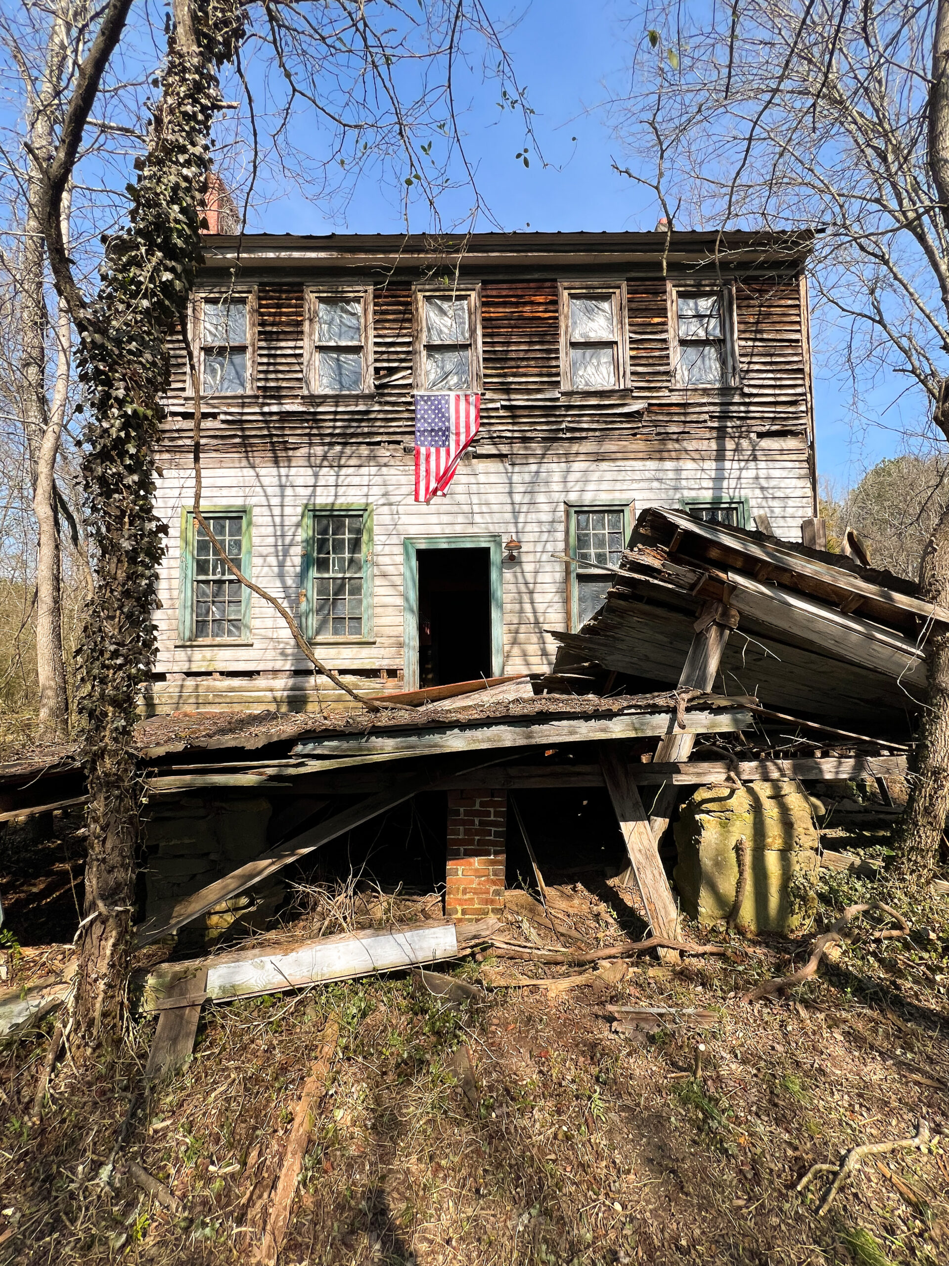
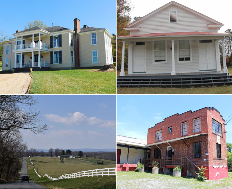
In Wythe County, the 19th-century Fulton Farm was home to Andrew Steele Fulton, a prominent attorney, political leader, and industrialist of Southwest Virginia, and his family. Located in the southern part of the county, the property overlooks the New River and the New River Trail to the north, and features the Fultons’ two-story Greek Revival residence. Farm buildings surrounding the house include a large timber-framed barn with an integral wagon drive-through, a corn crib and granary likely dating to the 1850s-1870s, and a ca. 1920 Dickelman corn crib of steel construction.
Fulton served as a representative in the Virginia General Assembly (1840-41, 1844-45) and was elected to the U.S. House of Representatives as a Whig in 1846. In 1852 Fulton and his wife, Sarah Kincannon Fulton, purchased a large parcel near the lead mining community of Austinville, where they erected the farmhouse. An important figure in the area’s industrial development, Fulton operated a leadworks facility adjacent to the property that yielded $9,000 worth of lead products in 1860. In that same year, Fulton’s farm produced large crops of corn and wheat. Fulton sold the farm in 1875, and a succession of lead mining companies owned the property throughout the early 20th century.
The history of educational development in Virginia grounds two new VLR listings:
- Built ca. 1916, the Chatsworth School in Henrico County provided education to African American children in grades 1 through 4 during Virginia’s era of public school segregation. Julius Rosenwald, the president of Sears, Roebuck and Company, contributed a matching grant for the school’s construction shortly before establishing the Rosenwald Fund in 1917. The visionary educator Virginia Estelle Randolph supervised industrial education at Chatsworth, where students learned a variety of subjects, from bookwork and banking to handicrafts and woodworking. The school also functioned as an immunization and health clinic for surrounding communities throughout its years of operation. Henrico County closed the school in 1955 as part of its consolidation efforts to accommodate increased enrollment levels.
- The Rivermont School in the City of Covington, the Alleghany County seat, exemplifies the Virginia Department of Education’s initiative to supply students with spacious, well-ventilated, and amply lit instructional areas. Constructed in 1938, it is one of the county’s most intact mid-20th-century educational buildings. In 1960 and 1970, new sections were built on the property to house additional classrooms and offices for changing educational curricula and increased enrollment. The Rivermont School served the neighborhood’s white children as part of the Covington Board of Education’s efforts to alleviate overcrowding in the city’s elementary schools. The school implemented progressive pedagogy and also functioned as a community gathering place throughout its years of operation.
The new VLR listings also highlight the impact of commerce on the commonwealth’s historic districts and towns:
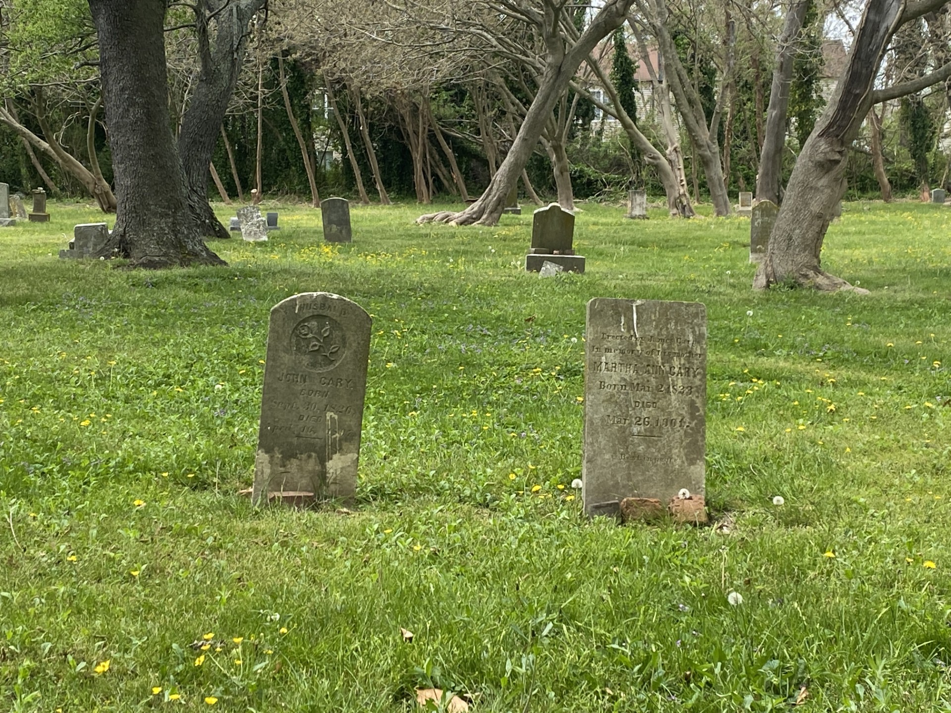
- Located just east of the Luray Downtown Historic District in Page County, Green Hill Cemetery was established in 1877 as a commercial venture by Daniel Fagan, a local marble cutter, Civil War veteran, and former mayor of Luray. Fagan designed Green Hill as an alternative, “rural” burial ground for the town after observing issues of overcrowding in church graveyards, health concerns from diphtheria and typhoid outbreaks, and the population growth as a result of the 19th-century railroad boom. Platted in the Victorian Garden style, Green Hill is surrounded by a mortared dolomite wall along its east, north, and west boundaries. Residences border the cemetery to the south. Green Hill contains 1,555 marked graves and 800 known unmarked graves. Markers for these plots are primarily carved from marble, but some are made of granite and metal. Sales of burial plots in the cemetery ceased in 1954. Persons buried within the cemetery contributed to the founding, growth, and history of Luray and the surrounding area.
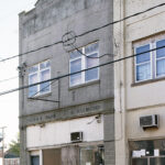
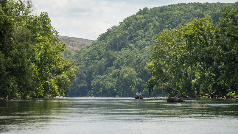
Photo credit: Calder Loth/DHR, 2005 - The Snickersville Turnpike stretches south to north from the village of Aldie in the Bull Run Mountains to the village of Bluemont—formerly known as Snickersville—in western Loudoun County. Before colonial traders and settlers began using it for exploration and commerce in the 18th century, the route served as part of a migratory and hunting footpath for the Sherando American Indians. Chartered in 1810 and completed in 1829, the 15-mile turnpike passes through the late-18th and early-19th century villages of Philomont and Mountville. It crosses over the historic Hibbs Bridge and winds between agricultural vistas of the Loudoun Valley. In the 19th century, the Snickers Gap Turnpike Company developed the route for commercial use by adding toll gates and adapting the road for wagon travel. The turnpike provided overland transportation for Loudoun’s agricultural products, but deteriorated for over half a century following the Civil War, before it was restored in the 20th century for automobile travel. Today, the turnpike follows its original 19th- and 20th-century alignment, serving the local community, farmers, and tourists alike.
The Board of Historic Resources approved two other VLR listings in its March quarterly meeting:
- The Shockoe Hill Burying Ground Historic District in the City of Richmond emerged following the disestablishment of the Anglican Church in the late 18th century. It embodies the city’s assumption of responsibilities for the medical and housing needs of the poor, for providing treatment and isolation facilities for victims of epidemics, and for burial of its residents. First laid out in 1799 for the purpose of establishing “a public burying ground for white persons,” the cemetery continued to expand throughout the 19th century. The tract encompasses three major properties previously listed on the National Register of Historic Places: the Almshouse, Shockoe Hill Cemetery, and Hebrew Cemetery. Additionally, three sites—the City Hospital and Colored Almshouse Site, the Shockoe Hill African Burying Ground, and the City Powder Magazine Site—have been identified as contributing resources to the district. They reflect patterns and changes in social and racial relationships, the impacts of war, medical practices and education, and the construction of historical memory.
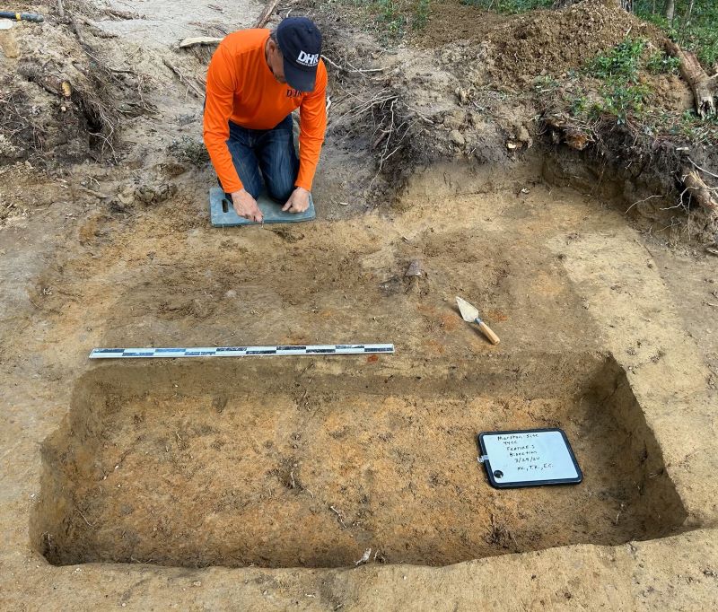
- Previously listed on the historic Registers, Timberneck in Gloucester County is a substantially undisturbed Tidewater plantation that was once home to the Catlett family. The Timberneck Boundary Increase encompasses 31.88 acres and, in addition to the previously listed dwelling and early 19th-century smokehouse, includes a late 19th- to early 20th-century well house, a 19th-century cemetery of the Catlett family, and archaeological site 44GL0387. The expanded boundary also includes 10 non-contributing resources—buildings, structures, and objects that are all part of the Machicomoco State Park infrastructure, which is located west of the Catlett house. The setting of Timberneck farm retains much of its open, agricultural viewshed. As a historic cultural resource, the property provides ample opportunity to study the farm’s establishment and maintenance over several centuries by the Catlett family and enslaved African Americans who lived and worked on the site.