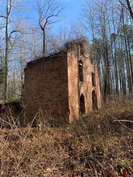
The Union/Glasscock Mill has roots dating to the 18th century, when it was first established by the Glasscock Family of nearby Indian Banks. The mill later burned, but the circa-1830s brick structure that remains may provide insight on life in the county’s Farnham community during the years leading up to the Civil War.
By Mike Clem | DHR Archaeologist for Virginia’s Eastern Region
Photographs by Joanna McKnight/DHR, 2024.
One morning in December of last year, as I headed to Richmond County to survey and inspect the ruins of the Union/Glasscock Mill with my colleague Joanna McKnight, DHR’s architectural historian for the Eastern Region, the odds were good that one or even both of us would end up falling off the slippery log that crossed Laton Swamp. It was the only access point for the mill. Fortunately, neither of us slipped and the mission was carried out successfully.
The adventure began with an email from an acquaintance in the archaeological world of Virginia. The archaeologist had been researching the mill in cooperation with the property’s owner, who was interested in having it listed on the National Register of Historic Places (NRHP). The current owner has a family connection to the mill and to the local community. They believe that the mill is a significant resource related to the long history of Richmond County and the Farnham area. The mill seat was established in the 18th century by the Glas[s]cock Family of nearby Indian Banks, but later burned, and the ruins that currently stand on the site date to circa 1833. There likely was at least one earlier mill in the area—probably two—dating back at least to the start of the 18th century. As DHR’s team for Virginia’s Eastern Region, Joanna and I responded to the email and agreed to make a field visit to examine the site and make recommendations for the owner’s goal of getting the property designated on the NRHP.
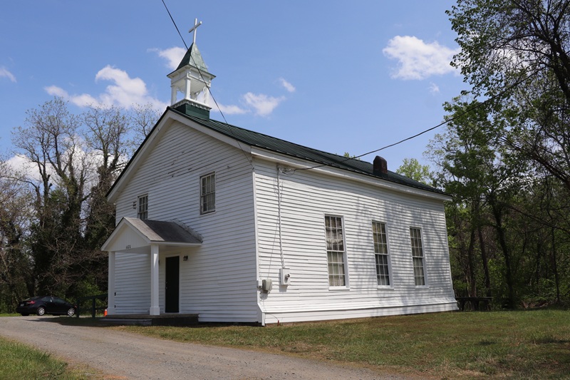
On December 17, 2024, Joanna and I met at a church located relatively close to the property. Even though the road leading to the mill had once been a county road traversed by school buses and local traffic well into the late 20th century, there is no present access to the inner part of the property. Some years ago, the mill dam failed and washed out the road, which was never repaired. Consequently, the road is overgrown and nearly forgotten from local memory. We followed the path of the road and had a brisk downhill walk on the late fall day. We eventually arrived at the bottomland along a small stream known as Laton Swamp. At this point the swamp was no more than a channelized stream some six to eight feet across. At one point in time, however, it was the primary source of water that, once dammed up, created quite a large millpond.

The dam was there, at the bottomland, and the breach was evident in a 20-foot-wide V-shaped divide in the sizeable structure. The work it took to manually build the dam must have been tremendous. The dam stood approximately 15 to 20 feet high and was an overwhelming visage on this lowland landscape.
We crossed through the dam breach and began walking upstream through what would have been the millpond. After a ten-minute walk across grassy scrub, we arrived at the villainous log that would serve as our bridge. It appeared to be an unidentified creature’s favorite spot for its daily “constitutional,” if you will. This left us with some uncertainty about our ability to traverse this dangerous crossing—a crossing that could ruin one’s reputation and pride without inflicting much physical torment. Now, the stream was perhaps six feet wide and barely two feet deep. After we made our way across the log, we quickly walked through the forest and arrived at a small bridge connecting the headrace which fed water from the millpond to the mill wheel. This race measures approximately ten feet deep and perhaps 15 feet in width. Like the dam, it had required a tremendous amount of labor to construct.


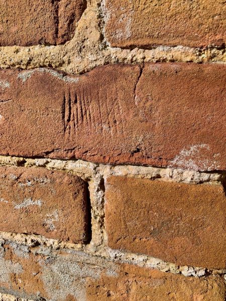
The mill ruins consist of three deteriorated walls, with the end wall containing remnants of a fireplace at both first and second floors. The mill’s large waterwheel and gears are partially intact. The brick walls are well constructed, boasting large openings for windows and at least one large, wide doorway into the lower floor. An interesting feature next to the door is a series of hash marks presumably used for counting the grain coming in or perhaps the bags of flour going out.
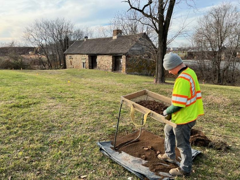
The Glascock/Union Mill is one of three Richmond County mills documented in the Virginia Cultural Resources Information System (VCRIS), DHR’s database of historic properties and sites. However, the mill appears to be the only remaining one of brick construction in the county. Researchers continue their efforts to unearth more about the history of the site. Besides the mill, there likely is a domestic site comprised of all the various out-structures typical of the time period. As we walked the property with the owner, we examined the landscape uphill from the mill for evidence of structural remains, such as bricks from a chimney collapse, domestic debris, and vegetation that would typically signal a habitation site. Unfortunately, there was nothing apparent on the surface, so we suggested that subsurface (shovel) testing would aid in gathering further physical evidence as to what the site may or may not have once held.