—New listings are in the counties of Northampton, Mathews, and Augusta; in the city of Norfolk; and in the town of Elkton—
Among five places listed today in the Virginia Landmarks Register are a Norfolk historic district settled by generations of Greek, Jewish, and African American communities, a 19th-century mountain village that was transformed into a bustling commerce hub by the Shenandoah Valley Railroad, and a school built for Black children during the Jim Crow era of segregation in Virginia.
The Commonwealth’s Board of Historic Resources approved the Virginia Landmarks Register (VLR) listings during its quarterly public meeting on September 21 in Danville, Virginia. The VLR is the commonwealth’s official list of places of historic, architectural, archaeological, and cultural significance.
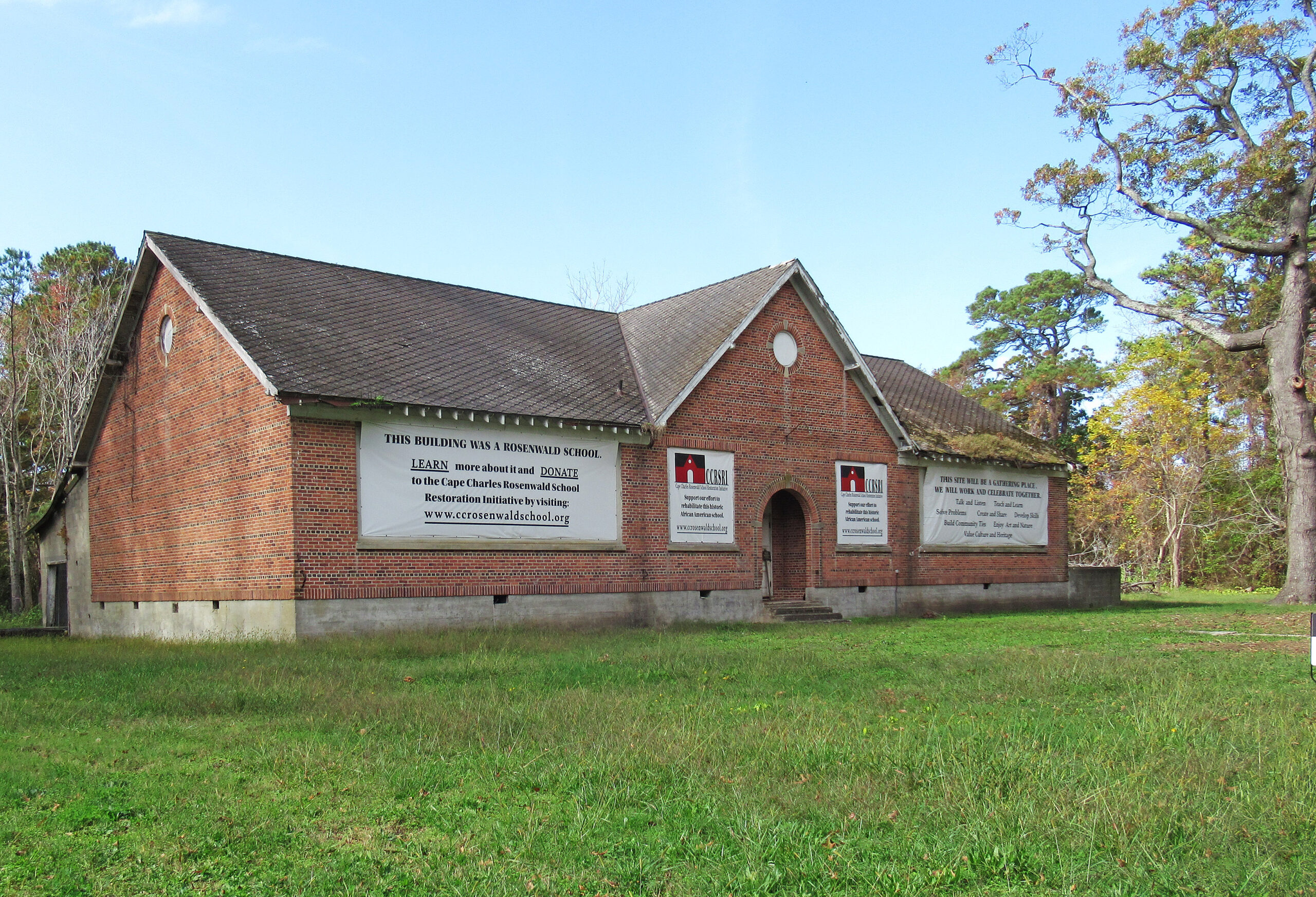
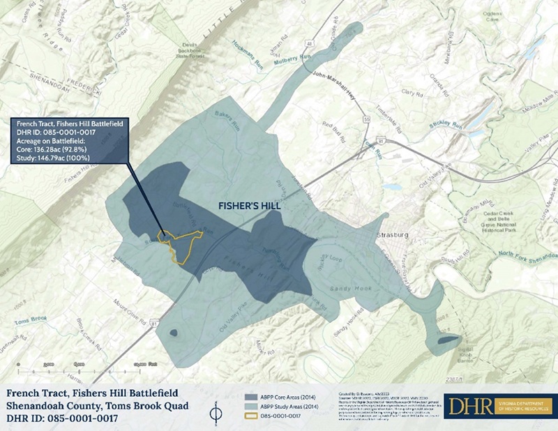
Built in 1929, the Cape Charles Rosenwald School in Northampton County was one of thousands of schools constructed using the Julius Rosenwald Fund for African American students during the Jim Crow era of segregation in Virginia’s public education system. Since the Rosenwald Fund covered only a small portion of construction costs, the school was built primarily using public funds from the state Literary Fund, the Town of Cape Charles, and a community organization known by various names including the Colored School League, the Negro School League, and the School Improvement League. As was typical of schools for Black children during segregation, grades were combined in classrooms at the Cape Charles school with each teacher instructing students of two grade levels simultaneously. Constructed of brick and stone, the school features banks of large windows to provide ample natural light and ventilation. The school’s interior remains largely intact. The building initially had no plumbing. There was a toilet and a water pump on the grounds. The auditorium was used for morning devotions, plays, and community meetings and presentations. Cooking and woodworking classes took place in the industrial room, which was later converted into a lunchroom and, later, into a bathroom. The school closed in 1966 after the county began consolidating its schools. The building was sold in 1968 to George W. J. Robberecht, and the next year it was passed to George Robberecht Seafood Incorporated and used as a seafood processing plant in subsequent years. Cape Charles Rosenwald School Restoration, Inc., bought the property in 2018.
•••
The new VLR listings also include historic districts representative of the Commonwealth’s long and complex history:
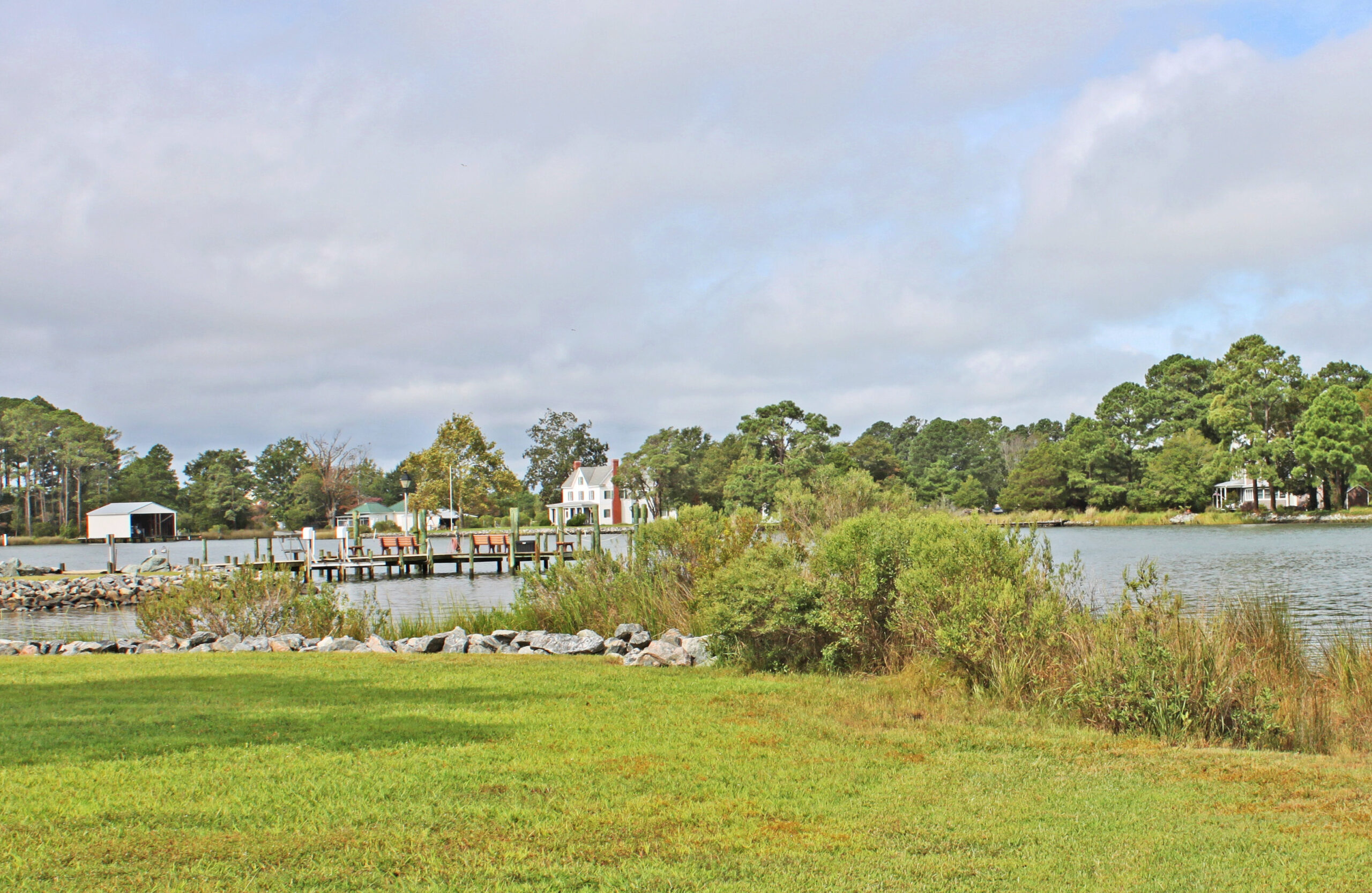
The Gwynn’s Island Historic District encompasses approximately 1,425 acres at the northern tip of Mathews County. The island is bounded on the north and east by the Chesapeake Bay and on the west by Hills Bay on the Piankatank River. Milford Haven Bay separates the island from the county mainland. The inlets Hole in the Wall and the Narrows have historically served as points of entry into the island from the mainland while Cherry Point, located at the mouth of the Piankatank, serves as a point of entry from the north. The Gwynn’s Island Historic District maintains ties to its 380-year heritage of farming and maritime trade anchored by the Chesapeake Bay. In the present day, much of the architecture on the island strongly reflects the “summer cottage” or resort community that developed starting in the 1920s. Many of the island’s single-family homes do not point to any designs of notable architects, but recurring architectural elements—characteristic materials, plans, and detailing—suggest the work of individual craftsmen or builders. Surviving historic structures and landscapes on the island continue to face dangers associated with global warming and climate change, such as rising waters and storm surges.
Gwynn’s Island was originally occupied by Virginia Indians starting in the Paleoindian period, approximately 10,000 to 15,000 years ago. Europeans first settled on the island following Hugh Gwynn’s 1642 patent. The population grew over the next two centuries and the land was adapted for cash crops and other income streams. The island’s period of historical significance begins in 1776 after the establishment of earthworks at Fort Cricket Hill and the Battle of Gwynn’s Island during the American Revolutionary War. The history of Gwynn’s Island is inextricably tied to the Africans and African Americans who helped build the island’s economy, community, and culture beginning as early as the 17th century. While the contributions of Africans and African Americans are difficult to discern in the island’s current cultural landscape, their stories are remembered by Virginians elsewhere throughout the state: from an origin story linked to Black indentured servants, to one of the first-known cases of enslavement of an African individual in Virginia, to the formation of a Revolutionary War-era British “Ethiopian” regiment of escaped enslaved men and their tragic fate, to the Black watermen and oystermen who built their lives on the island after the Civil War only to be forced off their property during the Jim Crow era. The island’s historical significance concludes in 1972, after the establishment of The Islander Hotel representing the peak of the district’s transition into a recreational destination.
•••
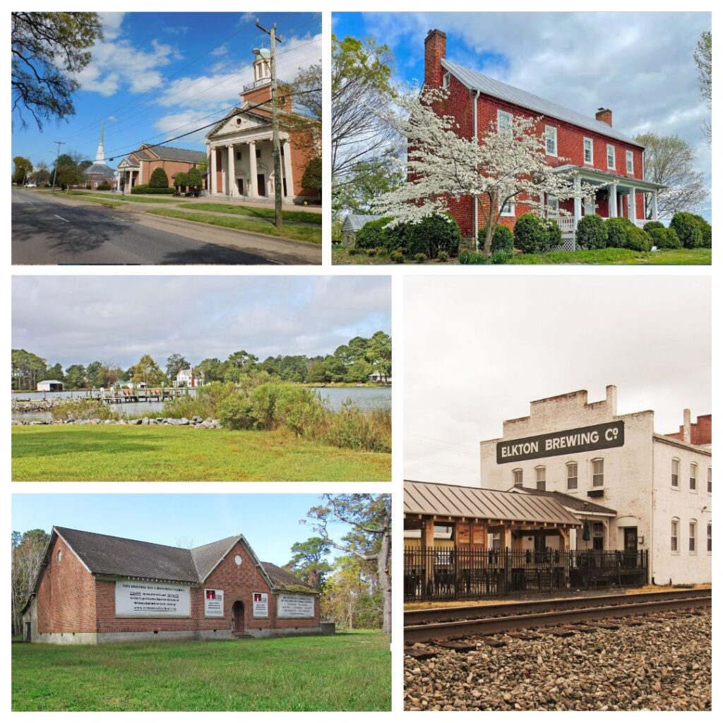
Located in the mountain town of Elkton in Rockingham County, near the heart of the Shenandoah Valley, the Elkton Historic District encompasses approximately 103 acres of land east of the South Fork Shenandoah River. The district, which stands fewer than 15 miles to the east of Harrisonburg, originally began ca. 1816 as a small crossroads community centered around a single store and homestead known as Conrad’s Store, located at the intersection of present-day West Rockingham Trail and Shenandoah Avenue. The community steadily grew throughout the 19th century and experienced several waves of residential and commercial development. The establishment of the Shenandoah Valley Railroad in 1881 transformed the district from a crossroads village into a bustling railroad town. The railroad brought new ideas, people, and businesses, and in 1908 the area became formally incorporated as the Town of Elkton. Most of Elkton’s early industry focused on agriculture. While large-scale industry such as milling and tanning occurred outside the historic district area, additional exports such as flour, lumber, and iron were occasionally shipped down the Shenandoah River to be sold in Georgetown, Harper’s Ferry, Baltimore, and other places, contributing to the economy of the entire town. Elkton’s expansion from a small crossroads settlement to a booming railroad town is also reflected in the architecture of its residential and commercial buildings. Romantic- and Victorian-era styles, including Italianate, Classical Revival, and Queen Anne, as well as vernacular-style buildings, featured prominently in Elkton during the late 19th century after the railroad arrived. As Elkton continued to prosper in the 20th century, empty lots were infilled and new buildings featuring architectural trends of the era, including Moderne, Minimal Traditional, Bungalow, American Foursquare, and Ranch styles, replaced older buildings. The growth of Elkton began to taper off in the second half of the 20th century, after rail service declined and automobiles supplanted railroads as the primary mode of transportation. Elkton’s role as an important hub for commerce and transportation finally came to a halt during the 1970s with the construction of a bypass connecting U.S. Business Route 33 to U.S. Route 340.
•••
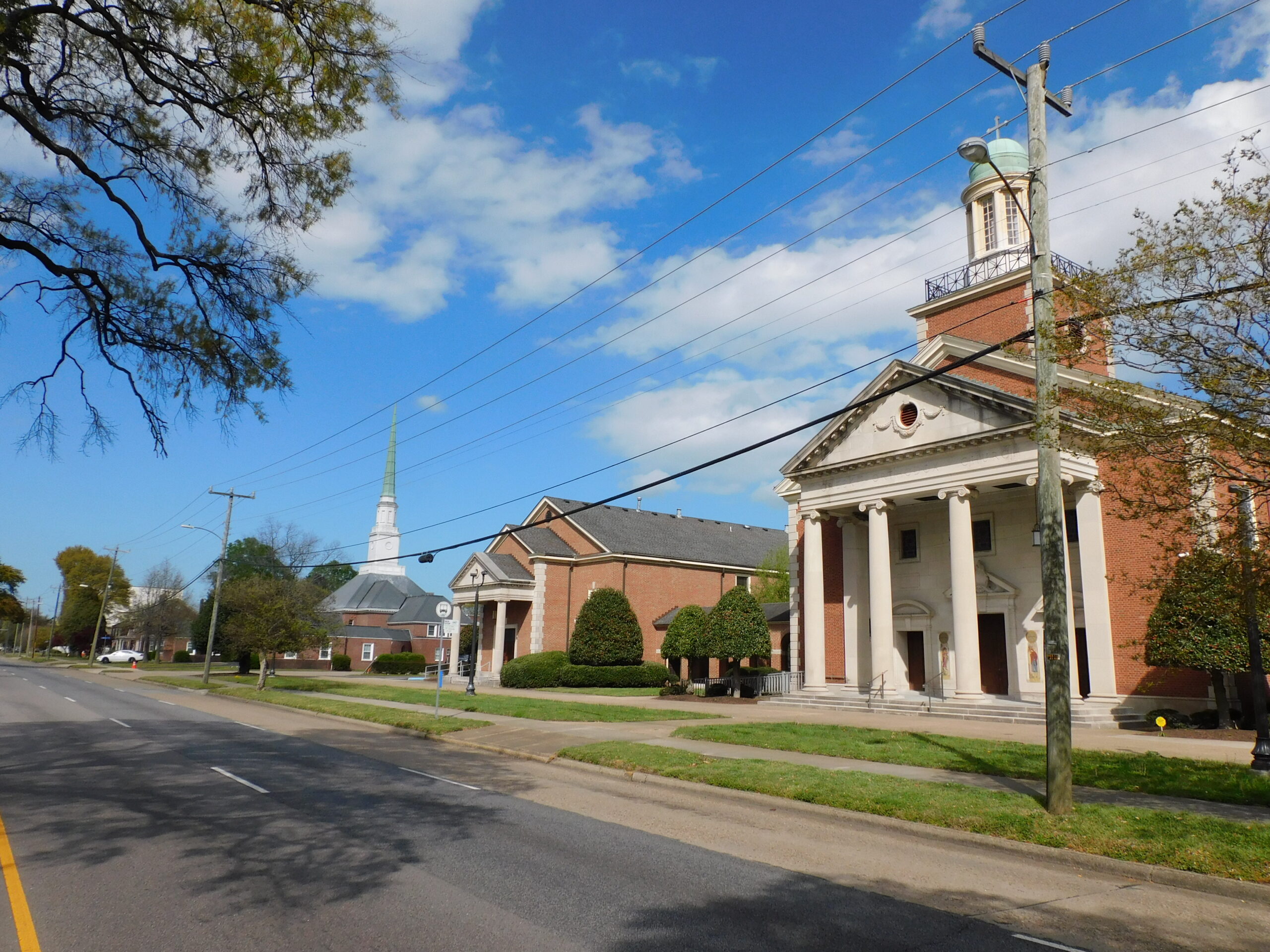
Encompassing approximately 60 acres just outside of downtown Norfolk, the Granby Street Suburban Institutional Corridor historic district is home to some of the city’s most impressive institutional architecture designed by locally prominent architects and firms. Suburbanization of the area began after Norfolk made its largest single annexation in 1923, which added 30 square miles of land and 30,000 additional residents into the city’s jurisdiction. The Institutional Corridor developed in the mid-20th century after the emergence of a nationwide trend to create self-sustaining communities in large cities where residents could live, learn, worship, and gather without having to travel downtown. All buildings within the corridor serve an educational, civic, religious, social, or cultural purpose. The buildings, in their current and historic uses, also represent the diversity of the surrounding Greek, Jewish, and African American communities and their respective histories. Home to the oldest Masonic Lodge in Norfolk (and one of the oldest in Virginia), the district is also associated with historic fraternal organizations and elderly care institutions that moved to the suburban corridor to better serve their members and to provide residents easier access to services. Several forms of high-style architecture feature prominently in the district, including Colonial and Classical Revival, Moderne, and New Formalism. The buildings were constructed using materials such as brick, stone, wood, and glass. Historic buildings within the corridor include Granby High School, Temple Israel, Greek Orthodox Church and Hellenic Community Center, Mt. Zion AME Church/Mt. Zion Baptist Church, Talbot Park Baptist Church, to name a few.
•••
Vernacular architecture distinguishes one new VLR listing:
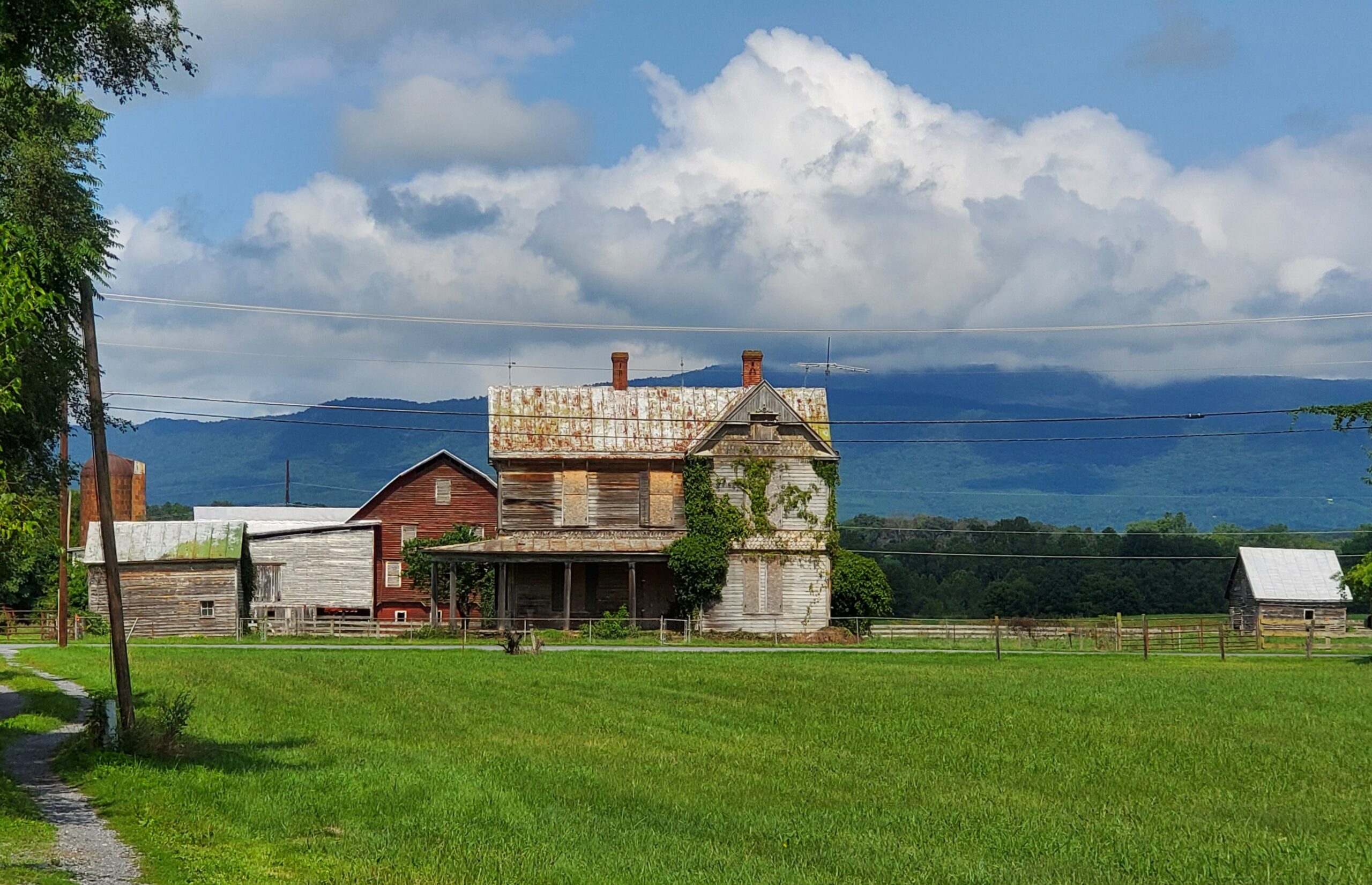
Constructed in ca. 1815, Long Meadow in southeast Augusta County sits on a promontory facing the Blue Ridge Mountains, overlooking a nearby creek known as Long Meadow Run. The property, which consists of approximately 25 acres, is located seven miles southeast of Staunton and five miles northwest of Waynesboro. Long Meadow is also located roughly six miles from New Hope, close to where the American Civil War Battle of the Piedmont (1854) was fought. An undeveloped 175-acre tract adjoins the property to the north and east, providing a sprawling vista of rolling hills, open farmlands, ponds, and wooded areas. Representative of 19th-century plantations in Augusta County and elsewhere in the Shenandoah Valley, Long Meadow serves as an excellent example of a vernacular interpretation of the Federal architectural style as seen in larger cities of the east coast. Architectural elements of the main house—constructed as a two-story, side-gable, five-bay, I-form brick dwelling with an integral rear brick ell—point to the tendency of local builders to adapt popular designs portrayed in architectural pattern books during the early republic and antebellum periods. Eight outbuildings and structures, including a spring house, smoke house, granary, root cellar, and sheep barn, accompany the main house on the property. Enslaved laborers and free Blacks overseen by an unknown master builder constructed Long Meadow using materials found on the property, such as limestone, clay, and white oak, pine, and elm trees.
John McCue, minister of the nearby Tinkling Spring Presbyterian Church, purchased the Long Meadow property in 1792 from Zachariah Johnston, a legendary Revolutionary War hero and Shenandoah Valley pioneer. Tax records as well as other estate documents confirm that African American individuals were enslaved at Long Meadow from 1792 through the end of the Civil War. Documents from a chancery court lawsuit over the estate in 1862 lists, for instance, 17 enslaved individuals by their first names with monetary values placed on each person. The fates of Long Meadow’s enslaved population are not presently known. The McCue family lived at Long Meadow for more than 130 years until 1948, when the property was bequeathed to Union Theological Seminary in Richmond. Subsequent owner Curry C. Carter, the Staunton lawyer and legislator known for his support of Virginia’s Massive Resistance movement during the 1950s and ‘60s, lived at the property for more than 20 years. The property passed to Hampden-Sydney College after Carter’s death in 1970.
•••
DHR will forward the documentation for these newly listed VLR sites to the National Park Service for nomination to the National Register of Historic Places (NRHP). Listing a property in the state or national registers is honorary and sets no restrictions on what owners may do with their property. The designation is foremost an invitation to learn about and experience authentic and significant places in Virginia’s history. Designating a property to the state or national registers—either individually or as a contributing building in a historic district—provides an owner the opportunity to pursue historic rehabilitation tax credit improvements to the building. Tax credit projects must comply with the Secretary of Interior’s Standards for Rehabilitation.