15 Historic Sites Added to the Virginia Landmarks Register
Published September 17, 2020
Bellevue||Detail of an 1859 map of Virginia showing Nottoway lands (red circle).||
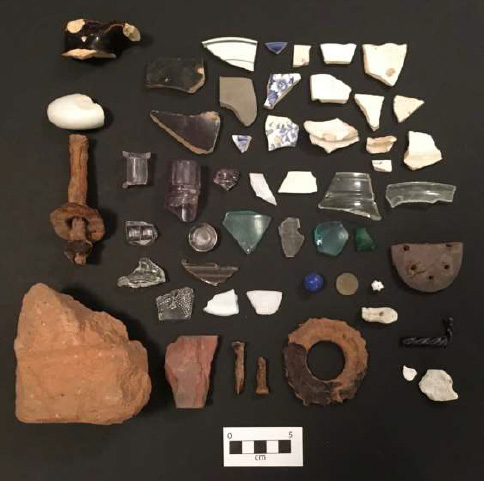
Artifacts from the Millie Woodson-Turner Site.
—VLR listings are in the counties of Albemarle, Arlington, Campbell, Craig (2), Essex, Fairfax, Halifax, Mecklenburg, Middlesex, Southampton, and Washington; and the cites of Alexandria, Charlottesville, and Danville—
Among 15 places approved in September for listing on the Virginia Landmarks Register is a site that traces back to Nottoway tribal reservation lands established in the colonial era; a historic district where one of the largest textile mill villages in the South evolved during the 20th century; and a rare surviving former “poor farm” established in the 1890s.
The Virginia Landmarks Register (VLR) listings were approved by the Virginia Board of Historic Resources during its quarterly public meeting on Sept. 17, which the Department of Historic Resources convened virtually due to the covid pandemic. The VLR is the commonwealth’s official list of places of historic, architectural, archaeological, and cultural significance.
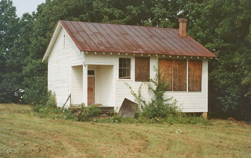
In Southampton County, the 1.8-acre Millie Woodson-Turner Home Site, located near the communities of Capron and Courtland, is where a farmstead once stood that Nottoway tribal members occupied from around 1852 to 1953. The Woodson-Turner site was part of the Nottoway tribal reservation lands established during the colonial era after the Nottoway entered a treaty with officials of the English Crown. It also is the first identified 19th-century Nottoway house site.
The tribe held Nottoway reservation lands in common until around 1830, when it began distributing allotments of the Nottoway lands to private ownership of tribal members. The Millie Woodson-Turner Home Site was one such allotment, which occurred around 1850. As one of the last remaining farms of the Nottoway’s Indian Town, the site has connection to the living memory of Nottoway descendants today.
After a 1953 chancery court-ordered auction of the land, the site left possession of Nottoway descendants, meaning prior to then the Millie Woodson-Turner Home Site had an uninterrupted indigenous tenancy, making it the only Iroquoian reservation site documented (to date) in the Commonwealth of Virginia.
The listing of the Millie Woodson-Turner Home Site was facilitated by a Multiple Property Documentation (MPD) Form, The Nottoway of Virginia, c. 1650–c. 1953, that the Virginia Board of Historic Resources also approved. The MPD for the Nottoway also will support future nominations of Nottoway-affiliated sites to the VLR and the National Register of Historic Places. (See more information and nomination.)
The Nottoway MPD recognizes the Nottoway as indigenous to the interior coastal plain of Virginia and North Carolina and closely related to the region’s other Iroquoian-speakers, the Meherrin and Tuscarora. After intermittent contact with Europeans from around 1560 to 1650, a brisk trade emerged from around 1650 to 1675 between the Nottoway and the English colonists who settled in the eastern Tidewater region.
The Nottoway, along with the Pamunkey, were signatories of the 1677–1680 Articles of Peace negotiated at the Camp of Middle Plantation, later established as the colonial capital of Williamsburg. Through the articles in the agreement, the Nottoway became “tributary” to the English king—a quasi-alliance—that forced the Nottoway and other tribes to acknowledge the dominion of the Crown, but confirmed Indian governments and territories as dependent sovereigns.
Photo credit: Ralph Harvard/DHR, 1973
The Nottoway tributary status was again confirmed by treaty in 1714 at the conclusion of the Tuscarora War. As stipulated in these treaties, the Nottoway lands were surveyed and two reservations established around their Indian Towns, in the landscape of what is today Southampton County. (See more information and MPD.)
In Danville, the roughly 512-acre Historic District encompasses the remaining buildings associated with the mill village of Schoolfield, an independent company town the textile giant Dan River Mills developed southwest of downtown Danville beginning in 1903. The district’s 1,005 historical buildings, largely retaining their original footprint and character, exemplify the industrial, commercial, community, and residential components of a southern mill village, one planned, constructed, owned, and operated by the textile company.
From 1882 until it closed in 2006, Dan River Mills produced cloth for home and apparel. One of the company’s two divisions in Danville, Schoolfield attracted workers, including many women, from the surrounding countryside seeking alternatives to farm work. Schoolfield Village provided for their economic, domestic, social, physical, religious, and educational welfare. The commercial core of the village survives as testimony to Schoolfield’s identity as an independent and self-sufficient community.
The district’s residential section of wood-frame housing for workers reflects the company’s decision in 1917 to hire professional planners and landscape architects to develop a “New Company Town,” one that eliminated the mill as the village focal point through the placement of trees and shrubs or built structures that obscured sight of the mills from the residential area.
Between 1919 and 1930, the company experimented with Industrial Democracy to give workers a voice in the mill operations. Despite this progressive policy, the management and workers of the mill actively excluded African Americans through the company’s employment and housing policies. As one of the largest industries in the city, management at the Schoolfield mills maintained a white majority population and political control in Danville almost as long as Dan River Mills existed.
The surviving section of Mill No. 5, a power plant and dam, water filtration plant, pump house and office, two warehouses, and various other supporting buildings and structures illustrate industrial design during the first half of the 20th century, as well as the mill’s operation as it evolved throughout the 20th century. Schoolfield’s two office buildings, the Italian Renaissance Revival–style 1903 main office, and the 1967 Modernist Miesian-style Executive Office Building, represent the very different periods in which each was constructed. The district also contains the previously listed three-building Schoolfield School Complex and the Schoolfield Welfare Building, as well as six churches and a large cemetery. (See more information and the nomination.)
In western Virginia, the former Craig County Poor Farm is important for its role in promoting the welfare of the county’s poor and needy residents during its years of operation between 1892 and 1921, and is among the few surviving examples of poor farms or poorhouses in Virginia. The poor farm superintendent’s two-story house, a simple dwelling of frame construction with vernacular Greek Revival elements, stood on the grounds by 1892. Next to the house stands an 1892 poorhouse cottage, one of three residential cottages that stood on the grounds in 1909. The two-bay, two-room cottage is reminiscent of servants’ quarters of the 19th-century era and conforms to the standard poorhouse lodging form in Virginia at the turn of the 20th century. The property also retains from its poor farm period a stone cellar structure, a frame granary-corncrib, the County Farm Cemetery where poor farm residents were buried, and a frame barn.
Photo credit: DHR, ca 1996
In 1921, the county sold the farm to a family who used the superintendent’s house as their farmhouse and converted the surviving poorhouse cottage to a chicken house. (See more information and the nomination.)
In addition to the Schoolfield Historic District, during its meeting Thursday, the Virginia Board of Historic Resources also approved five other districts:
The Flat Creek Rural Historic District, in Campbell County, presents an agrarian landscape of roughly 1,201 acres. It covers four primary properties: Flat Creek Farm, established in 1796 and two properties carved out of the former in the 20th century: East Hills Farm, dating to around 1926, and the Saunders Sawmill complex, constructed in 1946; as well as an adjacent ten-acre ensemble consisting of a church, cemetery, and rectory. The district’s range of buildings, sites, and structures illustrate Virginia’s west-central Piedmont agriculture over more than two centuries as well as the rise of sawmilling and ore extraction beginning in the late 1800s. Notable buildings include a collection of five distinct log buildings constructed between 1828 and 1847, including a slave quarters. The district’s collection of varied vernacular domestic, agricultural, and industrial resources represent the different types of households, farming practices, and mining operations in the rural Piedmont from 1797 through 1965. (See more information and the nomination.)
Essex County’s Occupacia-Rappahannock Rural Historic District encompasses a vernacular landscape of more than 44,884 acres that boasts a significant collection of buildings, structures, landscape features, and sites that highlight the evolution of a rural Tidewater community from the early 1700s through the mid-20th century. The Rappahannock River, smaller waterways, and historic roadways defined and shaped the area’s infrastructure and development, giving rise to a cluster of former riverfront plantations, and 19th and early 20th century crossroad communities and farms. The district’s period of significance extends from circa 1730, marking the construction of Glencairn, the oldest house in the district, to 1969, when the population increasingly relied on commuting lifestyles less dependent on agriculture for livelihoods, a trend that began prior to World War II. The district also includes numerous historic sites associated with its African American population. (See more information and the nomination.)
The Saluda Historic District got its start when Middlesex County voters approved a referendum in 1849 to move the county seat from Urbanna to a more central location, Saluda. In 1852, the Middlesex County Courthouse arose on a square where two roads meet, now the heart of the Saluda Historic District. Consisting of about 65 parcels, the district extends mostly along today’s US 33 and US 17 (historically, Gloucester Road). Its oldest house is the circa-1837 Oakenham, constructed for Thomas W. Fauntleroy, who was instrumental in promoting the referendum that relocated the county seat to Saluda. During the 1800s and early 1900s, Saluda retained its village character, one centered on the business of the courts. The first quarter of the 20th century saw prominent individuals construct substantial houses, while the century’s second quarter witnessed the construction of more modest dwellings. The district’s former Antioch Elementary School and the existing Antioch Baptist Church both have important historical associations with Saluda’s African American community. (See more information and the nomination.)
Photo: Thomas Jefferson Foundation
Virginia’s early railroad history ties in to two districts:
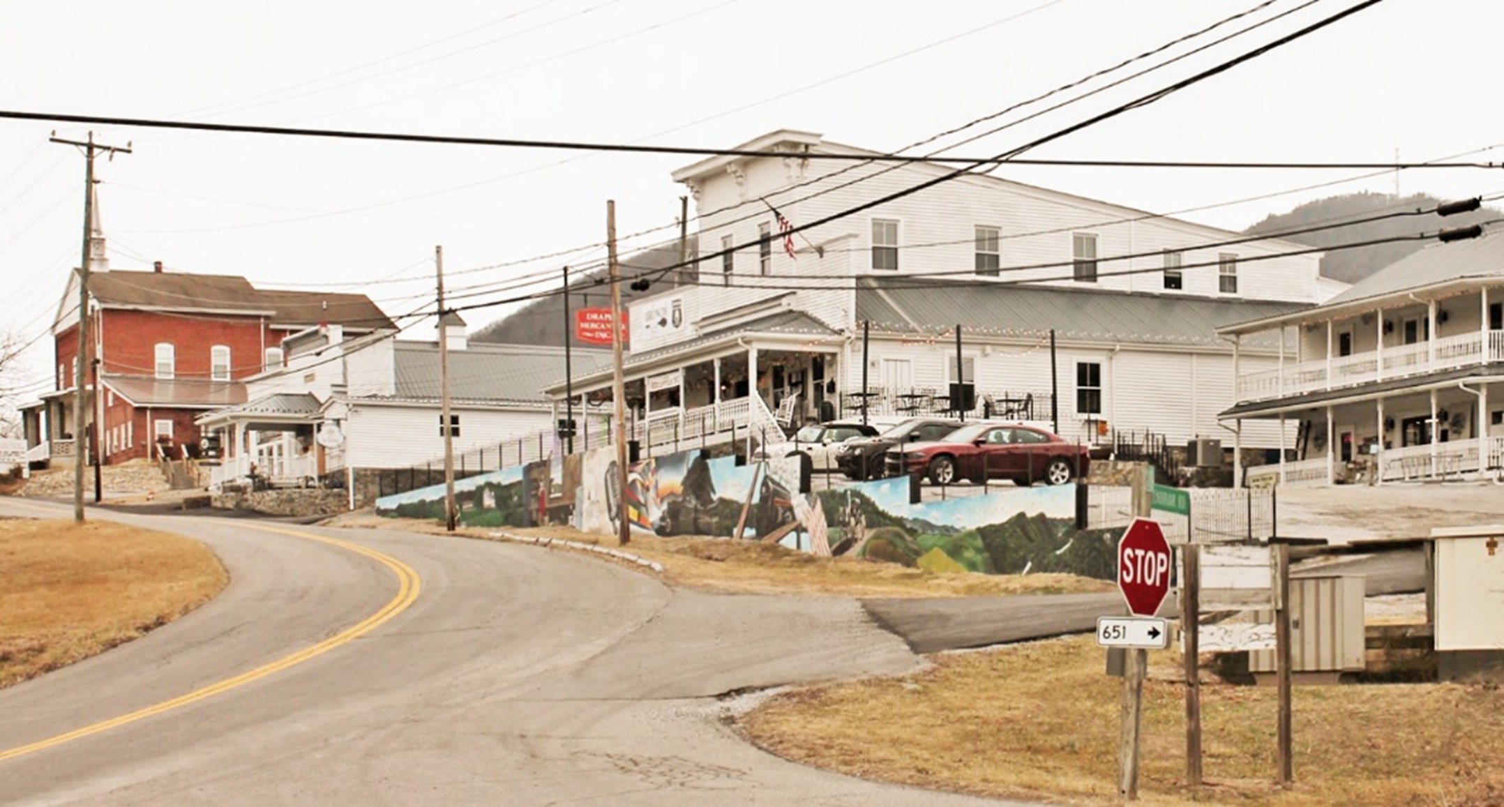
Chase City Warehouse and Commercial Historic District traces back to a mid-1700s crossroads community in northwest Mecklenburg County. The arrival in 1883 of the Atlantic Richmond and Danville Railroad to Chase City catalyzed rapid commercial development with the town serving the Piedmont area’s tobacco trade, lumber mills, and other agricultural activities. The Chase City Warehouse and Commercial Historic District, consisting of nearly 27 acres, arose quickly along Main Street (Route 47) and rail lines. It recalls the town’s emergence by the early 20th century as the county’s largest center of population and employment for many decades. It also reflects development after a 1903 fire that devastated the town and resulted in an ordinance mandating the use of masonry in building construction. The earliest commercial building in the district dates to 1905 and of particular note are the Southside Roller Mills, circa 1912, and the large Banner Tobacco Warehouse, circa 1915. The circa-1834 Shadow Lawn, a previously listed residence, is the only antebellum building in the district. Incorporated in 1873, the town saw its population begin declining by the late 1960s as economic trends shifted away. (See more information and the nomination.)
Located one block south of West Main Street in Abingdon (Washington County), the Depot Square Historic District began taking shape around 1856 when the Virginia and Tennessee Railroad extended the first railroad through Abingdon and constructed a depot. The railroad made Abingdon a regional center of commerce and trade and boosted the town’s growth. Today’s district consists of seven historical buildings, and a pedestrian bridge erected around 1922. The earliest building, the three-story Hattie House Hotel, now known as the Mercantile Building, was constructed in 1855. Around 1857 the Greek Revival-style Section Master’s House arose in tandem with the construction of the first depot. Also around 1857, the Depot Hotel, a two-story frame dwelling was erected, built by prominent local brickmason and contractor William Fields, who also built the district's Fields House around 1860. Around 1869, the Virginia and Tennessee Railway built a new Freight Depot in the Italianate style to replace the original one burned during the Civil War. In 1910, Norfolk & Western Railway constructed its passenger depot, a one-story, brick Tudor Revival-style building. The most recent building contributing to the district is a one-story Commercial-style edifice that housed a barbershop and billiards parlor, built in 1922. With its two adjacent train depots serving as the district’s central focal point, the Depot Square Historic District recalls Abingdon’s significant railroad history. (See more information and the nomination.)
Two high schools constructed during Virginia’s era of segregation also were approved Thursday:
The George Washington High School in Alexandria has functioned as a school since its construction for white students in 1935, with funding provided by the Federal Emergency Public Works Administration, one of President Franklin D. Roosevelt’s New Deal initiatives during the Great Depression. The school is one of the largest and signature examples in Alexandria of Art Deco, a popular style of the period. In 1938 and 1947, south and north wings were added to the main building, and in 1941, the city built a separate Mechanical Arts Building, also executed in the Art Deco style. Alexandria desegregated the school in 1965. Although not historically significant to the school’s listing on the VLR, its notable alumni include: “Mama” Cass Elliot and John Phillips of the 1960s folk-rock group The Mamas & The Papas; Jim Morrison, lead singer for the rock group The Doors; Willard Scott, a TV personality who was with NBC’s Today show from 1980 to 1996; Guy S. Gardner, a former NASA Astronaut, and Francis Hammond, a Korean War veteran posthumously awarded the Congressional Medal of Honor. (See more information and the nomination.)
Jackson P. Burley High School in Charlottesville is named for a local African American educator and community leader. The building represents a rare instance in which two localities—Charlottesville and Albemarle County—sought to achieve “separate but equal” educational facilities during segregation—and at a time when successful legal suits underway elsewhere in Virginia challenged the unequal and overcrowded conditions in black schools. The agreement to construct a new high school for black students resulted from the overcrowded and seriously insufficient facilities for African Americans in both jurisdictions. Opened in 1951, Jackson P. Burley High School was part of an effort by many jurisdictions to support segregation in Virginia by constructing new and well-equipped separate but equal high schools for African American students. That approach ended when the U.S. Supreme Court ruled in 1954 in Brown v. Board of Education that segregated public schooling was unconstitutional. Architecturally, the Burley school building is one of the first schools in the region designed in the modern Stripped Classical style. In 1967, the city and county ended school segregation, and the building now houses Jackson P. Burley Middle School, now solely owned by Albemarle County. (See more information and the nomination).
African American history is also central to another VLR listing in Albemarle County:
River View Farm is important for its legacy as a prosperous working farm owned by an African American family, members of a community of black farmers, tradespeople, businesspersons, ministers, and educators centered on Union Ridge and Hydraulic Mills in Albemarle County during the late 1800s. The formerly enslaved Hugh Carr purchased the land in 1870 and built the existing farmhouse around 1880, where he and his wife, Texie M. Hawkins, raised seven children, encouraging them to pursue higher education. Locally, the property’s importance extends as well to its affiliation with Carr’s daughter, Mary, and her husband Conly Greer. Mary Carr Greer became a teacher, then principal for 20 years at Albemarle Training School, the only post–elementary school available to African American students in Albemarle during segregation until 1951, when Jackson P. Burley High School opened for black students. After Carr’s death in 1973, the county in 1974 named a newly built school Mary Carr Greer Elementary. Conley Greer was Albemarle’s first African American agricultural extension agent, a career spanning 1918 to 1953 during which he educated and advised farm families about science-based farming practices the U.S. Department of Agriculture promoted. In 1937-38, Greer used USDA plans when he constructed a large barn that still stands at River View Farm. The Carr farmhouse evolved during the 20th century with a 1915 addition and the incorporation of plumbing, electricity, and central heating and other improvements. (See more information and the nomination.)
Three VLRs approved are notable for their architectural design:
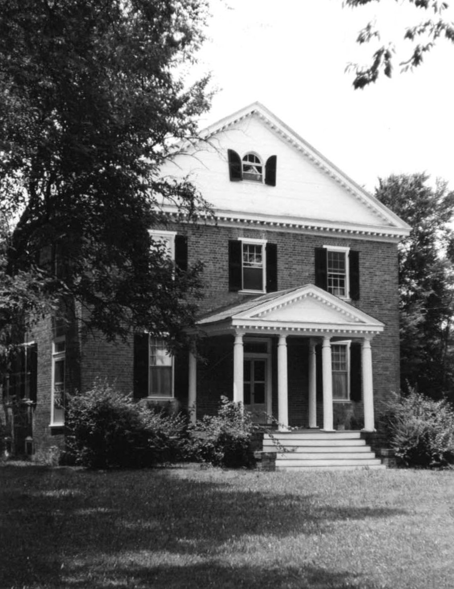
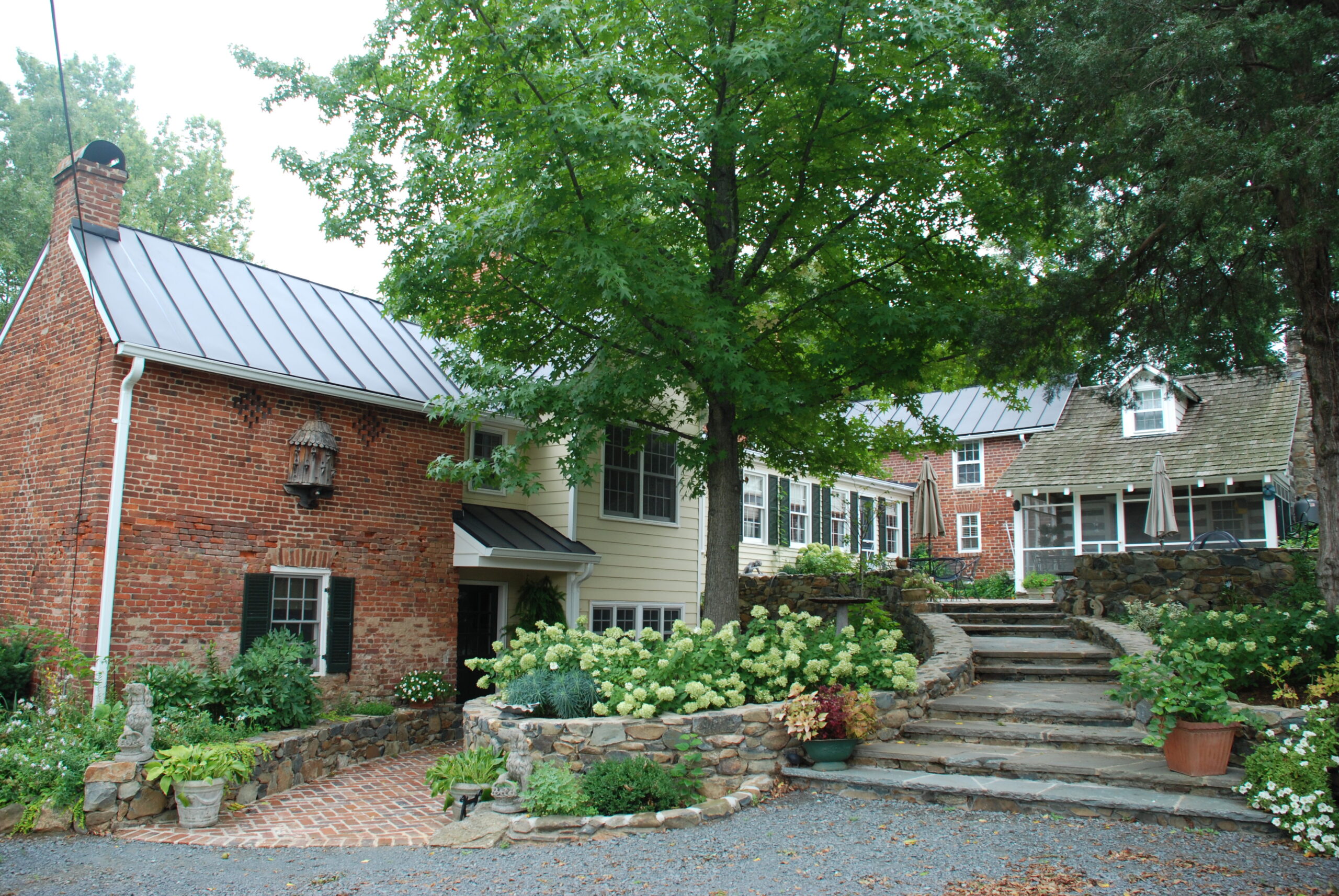
Located in the Sinking Creek Valley of Craig County, Bellevue is a Federal-style two-story brick house updated in the Victorian style around 1900. It is the only antebellum brick house to survive in the county and possibly the only one ever built. The house was constructed for merchant Robert Wiley about 1833. His son, Dr. Oscar Wiley, practiced medicine in a circa 1860 Greek Revival office in the front yard. In the late 1800s, Scottish-born livestock breeder Thomas Bonar Neilson owned the farm and reportedly in 1893 kept there “the largest flock of Shropshiredown sheep in the State.” The house features Flemish and common bond brick construction, and Federal-style detail consistent with the finer houses of the 1810s to 1830s period, the heyday of the style’s popularity in western Virginia. The circa 1900 decorative front porch exhibits exceptional Victorian-era carpentry and millwork. In addition to a cemetery and the foundation for a building of unknown function (possibly a store), the property also features a bunker-like potato storage cellar and a pyramidal-roofed icehouse with sawdust-insulated walls, both constructed during the first quarter of the 20th century. (See more information and the nomination.)
Photo credit: DHR, 1998
Photo credit: Reauchan Wood, 1990
Photo credit: Jana Bean, 2017
Located in Fairfax County on the highest point of rolling, wooded hills above the Potomac River, Bois Dore, completed in 1951, is the important for its architecture and two designers, Thomas Tileston Waterman, a prominent architectural historian and preservationist, and William Max Haussmann, the chief architect of the National Park Service (NPS) Capital Region between 1952 and 1963. Waterman and Haussmann, notable players in the field of architecture and architectural history, contributed to the practice of historic restoration and to the direct preservation of historic structures, particularly on the East Coast. After Washington socialite Karen Gram Scott commissioned the project, Waterman designed an H-shaped, French Villa-style house and two-car garage with living quarters on the second floor. Since Waterman was not a licensed architect as required by Virginia state building codes, he collaborated with Haussmann with whom he had worked for several decades. Haussmann became the architect of record for the project and completed the designs in 1950. The house remains much as Waterman and Haussmann designed it with original exterior finishes and interior flooring, woodwork, fireplaces, and plaster walls. (See more information and the nomination.)
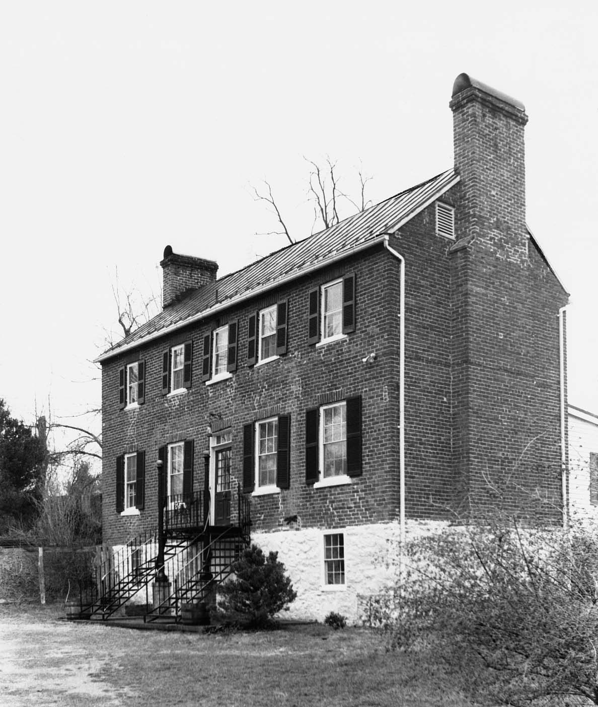
Located on the Hyco River in south-central Halifax County, Oak Cliff is significant for its diversity of architectural features, which derive from Georgian, Federal, Greek Revival and Gothic Revival styles. Built originally in the Georgian style around 1792 for General Joseph Jones, a Petersburg merchant, planter, and civic leader, the house and property may have served as Jones’s summer residence and base of operations for the management of his upcountry plantations. Oak Cliff’s transitional Federal-Greek Revival details relate to a 1830s remodeling during the ownership of William and Jane Carrington. A wing of the building with Greek Revival detail was added about 1850. On the grounds are a Carrington family cemetery with a decorative iron fence and professionally crafted marble tombstones, as well as the circa 1880s stone abutments of an Atlantic & Danville Railway bridge, and pedestrian-vehicular bridges over the Hyco River, which borders the property. (See more information and the nomination.)
Also approved for listing on the VLR is Glebe Apartments (now known as Knightsbridge Apartments) in Arlington County. The apartments exemplify the multi-family garden apartment complexes that arose between 1934 and 1954 in Arlington County as a response to the critical need for moderately priced housing for a growing population in the greater Washington D.C. area. That need began in the 1930s with the influx of people who found work with a burgeoning federal government under the New Deal and the government’s subsequent expansion as the U.S. prepared for World War II. Following World War II, the small Glebe Apartments complex, constructed in 1947, provided housing for some of the thousands of veterans, among other people, who settled in the county. Similar to other garden apartments in Arlington, Glebe Apartments incorporated the standards of forward-thinking planners and housing reformers who promoted the benefits of modern, efficient interior floor plans and attractively planned residential communities to people of moderate means. Executed in a Colonial Revival-style, Glebe Apartments’ design specifically met the moderate means of workers and their families. (See more information and the nomination.)
At the September meeting, boundary increases for two previously listed historic districts were approved:
The Department of Historic Resources will forward the documentation for these newly listed VLR sites to the National Park Service for nomination to the National Register of Historic Places.
Listing a property in the state or national registers is honorary and sets no restrictions on what property owners may do with their property. The designation is foremost an invitation to learn about and experience authentic and significant places in Virginia’s history.
Designating a property to the state or national registers—either individually or as a contributing building in a historic district—provides an owner the opportunity to pursue historic rehabilitation tax credit improvements to the building. Tax credit projects must comply with the Secretary of Interior’s Standards for Rehabilitation.
Virginia is a national leader among states in listing historic sites and districts on the National Register of Historic Places. The state is also a national leader for the number of federal tax credit rehabilitation projects proposed and completed each year.
DHR BLOGS
The Virginia Department of Historic Resources’ 60th Anniversary
Battlefield Preservation: The French Tract and Civil War History
Field Notes: Surry, Sussex, and Southampton Counties
Call for Submissions: Share Your African American Cemetery & Graves Fund Success Story
Preservation Incentives 2025-26: Recent Highlights from DHR’s Preservation Easement and Historic Rehabilitation Tax Credit Programs
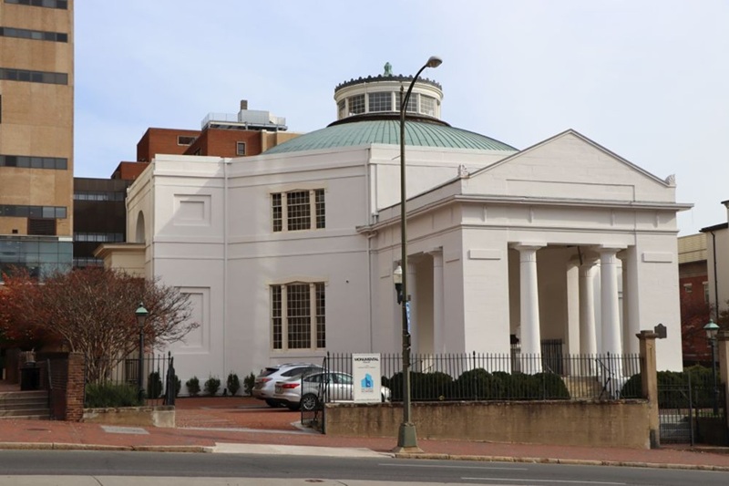
Preservation Easement Stewardship Spotlight: Monumental Church in the City of Richmond
POINT OF CONTACT
Related Press Releases
State Historical Marker to Be Dedicated in Staunton for Queen Miller Home
State Historical Marker to Be Dedicated in Mathews County for Black Exodus from Gwynn’s Island
Virginia Awarded $2M by NPS to Document Areas Impacted by Hurricane Helene